The Kona Coffee Belt: Where Kona Coffee Actually Grows and Why
Kona coffee only legally grows in one narrow strip of one island: about thirty miles long, two miles wide, on the western slopes of two volcanoes. Here is what that strip actually is, why its weather makes the coffee, and how to drive it.
Short answer
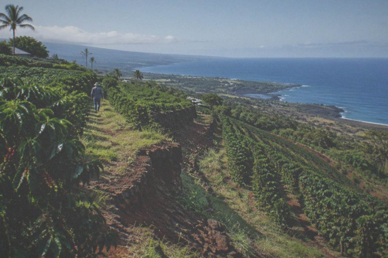
The Kona coffee belt is the North and South Kona districts on the west side of Hawaii Island, roughly 30 miles long and 2 miles wide, between about 500 and 3,200 feet elevation on the slopes of Hualalai and Mauna Loa. Only coffee grown there can legally be called Kona. Sunny mornings and afternoon clouds do the rest.
What is the Kona coffee belt?
The Kona coffee belt is the stretch of the North and South Kona districts on Hawaii Island where Kona coffee is legally allowed to grow, roughly 30 miles from north to south and only about 2 miles wide, sitting between roughly 500 and 3,200 feet of elevation on the western slopes of the Hualalai and Mauna Loa volcanoes. Coffee grown anywhere else cannot carry the name.
That legal boundary matters more than most visitors expect. Under Hawaii's labeling rules, "100% Kona Coffee" means beans grown only in the North and South Kona districts, meeting the state's green coffee grading standards. The Kona Coffee Council runs a voluntary Seal of Approval on top of that, with an audit trail back through the mill. So when a bag in an airport shop says Kona and the belt's farms are 30 miles of two-mile-wide real estate, you can start doing the arithmetic on how much genuine Kona coffee there really is.
The belt is small because the conditions are narrow. Coffee trees here want a specific combination: enough rain, but not the drenching the island's east side gets; warmth without baking; and a dry spell at the right moment to trigger flowering. The western Kona slopes are the one place on Hawaii Island where all of that lines up, and it lines up in a band you could walk across in under an hour.
This guide is the geography of that band: where it runs, why the elevation and the daily cloud rhythm matter, which farms sit on it from north to south, and how long the drive between them takes. If you are still choosing what to book, start with the Kona coffee farm tours overview, which compares every bookable walk; this page is for understanding the ground underneath them.
Where does the belt actually run, north to south?
The belt starts just north of Kailua-Kona and runs south past Captain Cook and Honaunau, following the Mamalahoa Highway along the lower slopes of Hualalai and Mauna Loa. Its core growing zone sits between about 700 and 2,000 feet, with farms scattered from roughly 500 feet near the coast road up to about 3,200 feet. Holualoa, Honalo, Kealakekua and Captain Cook are the towns on it.
Driving it is easier than reading about it. From Kailua-Kona, Holualoa is about 8 minutes away, 3.9 miles up the hill. Honalo adds another 6 minutes or so. Captain Cook, near the belt's southern heart, is 23 to 26 minutes from town, 12.3 miles down Mamalahoa Highway. The whole belt is a single morning's drive if you do not stop, and nobody should drive it without stopping.
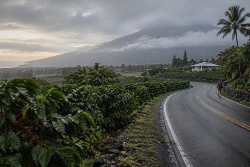
The northern anchor is Kaloko, about 10 minutes north of Kailua-Kona, where Mountain Thunder's plantation campus sits. The southern end of the classic farm cluster is around Captain Cook and Kealakekua, where some of the oldest family farms in the district operate. One thing the belt is not: the Hilo side. Ohana Ranch, one of the bookable tours on this site, is in Mountain View on the east side of the island, about 90 minutes from Kailua-Kona, and its coffee is not Kona coffee. It is a fine tour, but it is a different district with different weather.
If you are timing a visit around what the trees are doing, the harvest runs late August through January, with peak picking October through December. The Kona coffee harvest season guide covers that calendar in detail.
Why does elevation matter so much?
Between roughly 700 and 2,000 feet, the belt gets the mix coffee trees want: warm days around 85 degrees, nights near 60, and enough altitude to slow the cherry's maturation so sugars and acids build instead of rushing. Below the band it is too hot and dry; above it, too cool and wet. That is why the farms cluster on one thin strip rather than spreading down to the coast.
Slow ripening is the whole trick. At belt elevation a coffee cherry matures over months rather than weeks, and the sugars, acids and aromatics that end up in the cup develop along the way. Growers talk about this the way winemakers talk about slow-ripening fruit: same physics, different crop. It is also why the elevation range appears in nearly every serious description of what makes this district's coffee distinct.
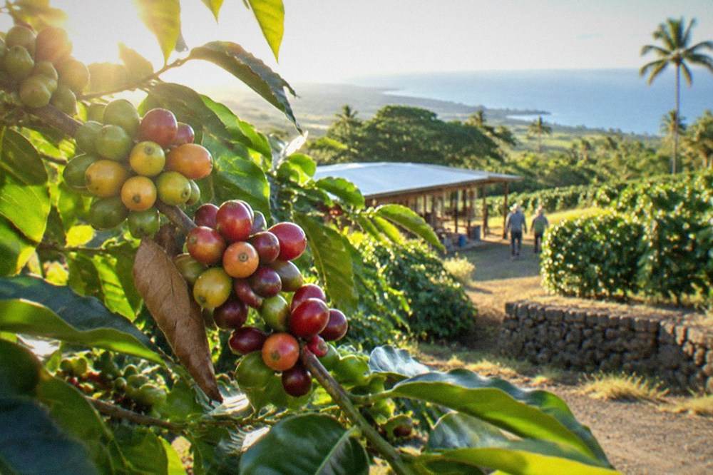
The numbers behind the belt's coffee are worth knowing before you visit a farm, because the guides on these tours will use them:
Less supply plus record prices is the backdrop to everything a farmer tells you on a tour right now. The 2025-26 crop is smaller, and the price of genuine Kona reflects it. When a tasting room pours you something at a premium, that premium starts at the farm gate, not the gift shop.
What do afternoon clouds have to do with it?
Almost everything. The Kona slopes get sunny mornings and a near-daily buildup of clouds or light rain each afternoon, a pattern locals rely on so heavily it has its own name, and it shades the trees at the hottest part of the day while supplying the roughly 60-plus inches of annual rain the crop needs. Without that daily cloud shield, the elevation alone would not be enough.
The rhythm is remarkably reliable. Mornings open clear, which matters because coffee flowers and ripens best with strong morning sun. By early afternoon, moisture pushed up the slopes condenses into cloud, the trees get shade and a drink, and the temperature drops. Growers on the belt plan their picking, drying and pruning around this cycle the way farmers everywhere plan around weather, except here the forecast barely changes.
The soil is the second half of the recipe. The western slopes are porous volcanic soil, well drained and rich in minerals, which suits coffee trees that hate standing water around their roots. Rain moves through the ground fast, taking nutrients with it down the slope, which is part of why belt farms are small and hands-on: the trees need constant attention rather than a big mechanized operation.
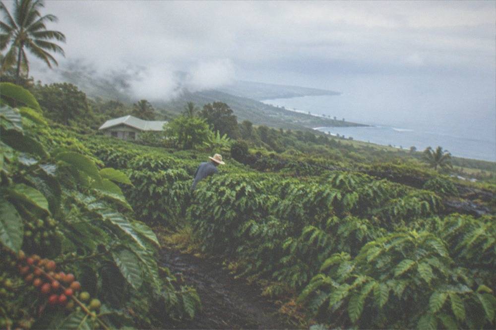
Put the three factors together and you get a district that behaves like a single farm with 30 miles of rows:
| Factor | What the belt gets | Why it matters for the coffee |
|---|---|---|
| Elevation | Core zone about 700 to 2,000 feet | Slows cherry maturation, builds sugars and acids |
| Morning sun | Reliable clear mornings | Ripening and flowering need strong light |
| Afternoon clouds | Near-daily cloud cover or light rain | Shades trees at peak heat, supplies moisture |
| Rainfall | Roughly 60-plus inches a year | Enough water without the east side's drenching |
| Soil | Porous volcanic ground | Fast drainage, mineral-rich feeding of the roots |
| Temperature | Days near 85, nights near 60 | Stable warmth without heat stress |
No other district in Hawaii has this exact combination at scale, which is why the name Kona is protected rather than generic. The state's labeling rules enforce it: a blend can only be called a Kona blend if it contains at least 10 percent Kona-grown coffee today, and that minimum rises to 51 percent on July 1, 2027. The full rules live in the Hawaii Department of Agriculture's labeling guidelines, and they are the reason a farm tour here includes a talk about what is actually in the bag.
Which farms sit on the belt, and which tours cover them?
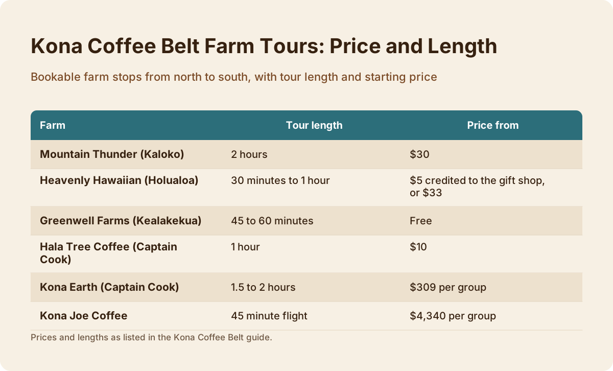
From north to south the bookable belt stops are Mountain Thunder at Kaloko, Heavenly Hawaiian at Holualoa, Hala Tree at Captain Cook, Kona Earth at Captain Cook, and Greenwell at Kealakekua, which runs a free daily tour direct with the farm. Kona Joe, where the helicopter landing tour touches down, is also on the belt. Each farm sells a different kind of visit, from a $5 sampler to a private group walk.
Here is the map, north to south, with the bookable tour for each farm:
| Farm | Belt location | Bookable tour | Price from | Length | Notes |
|---|---|---|---|---|---|
| Mountain Thunder | Kaloko, 10 minutes north of Kailua-Kona | "Organic Farm and Mill, 2 Hours" | $30 | 2 hours | Farm plus working mill, 4.8 from 27 reviews |
| Heavenly Hawaiian | Holualoa | "Short Sampler Walk, Max 25" or "Full-Hour Farm Walk, Max 20" | $5 credited to the gift shop, or $33 | 30 minutes to 1 hour | 5.0 from 188 reviews on the sampler |
| Greenwell Farms | Kealakekua | Free tour direct with the farm, daily every 30 minutes from 8:30am to 2:00pm | Free | 45 to 60 minutes | No reservation needed, not a bookable card |
| Hala Tree Coffee | Captain Cook | "Small-Group Farm Walk, Max 12" | $10 | 1 hour | 4.9 from 80 reviews, capped at 12 guests |
| Kona Earth | Captain Cook | "Private Crop-to-Cup Farm Tour" | $309 per group | 1.5 to 2 hours | Private group, meeting point confirmed at booking |
| Kona Joe Coffee | On the belt | "Helicopter Landing Plus Tasting, 45 Min" | $4,340 per group | 45 minute flight | Lands 20 minutes at the farm for a private tasting |
Two honesty notes on that table. Greenwell's free tour is run directly by the farm, walk-up, every 30 minutes through the day; it is not one of the bookable cards on this site, and that is exactly why it is popular. And the helicopter tour is a flight with a landing at Kona Joe, not a walking farm tour; you see the belt from above, which is the only way to grasp how narrow it really is. The rest of the planning pages sit on Kona Coffee Tours.
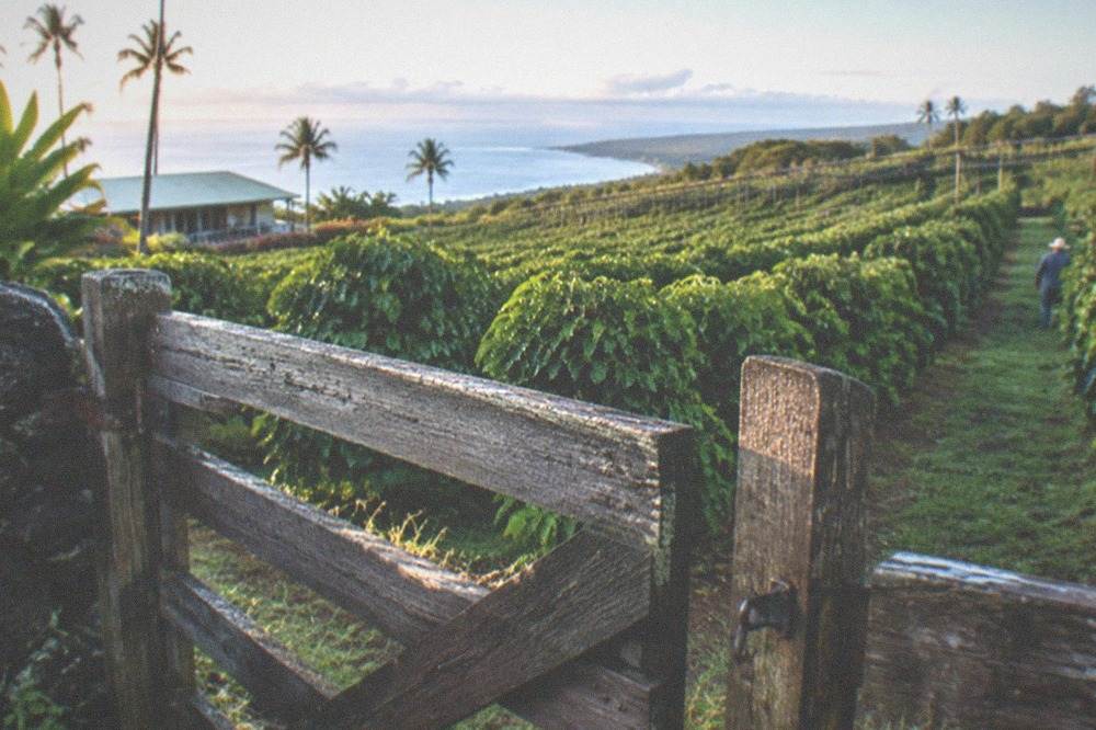
For a deeper look at the two farms visitors ask about most, see the Greenwell Farms tour guide and the Heavenly Hawaiian farm guide. The free Kona coffee tours guide covers every no-cost option on the belt, including Mountain Thunder's free short walk-in tours direct with the farm.
How long does the drive between belt farms take?
Plan on the whole belt being a single morning or afternoon: Kailua-Kona to Holualoa is about 8 minutes, to Honalo about 14, and to Captain Cook about 23 to 26 minutes. Farm to farm along Mamalahoa Highway, you are usually 5 to 15 minutes apart, so a two-farm day is easy and a three-farm day is ambitious but doable if your first stop is early.
The practical drive times, measured from Kailua-Kona:
| Destination | Distance | Drive time from Kailua-Kona |
|---|---|---|
| Kaloko (Mountain Thunder) | 10 minutes north of town | About 10 minutes |
| Holualoa (Heavenly Hawaiian) | 3.9 miles | About 8 minutes |
| Honalo | 8.4 miles | About 14 minutes |
| Kealakekua (Greenwell) | South of Honalo | About 20 minutes |
| Captain Cook (Hala Tree, Kona Earth) | 12.3 miles | 23 to 26 minutes |
Those figures are car times in normal traffic. The road is a two-lane highway with coffee on both sides once you are on the belt, and traffic thickens around school hours and festival week. If you are visiting during the Kona Coffee Cultural Festival, which runs November 6 to 15 in 2026, expect the belt to be busy and book anything with a cap on group size well ahead; the schedule is on the festival's official site.
A sensible belt day looks like this: one morning tour at a northern or Holualoa farm, lunch in Holualoa village, then a southern stop near Captain Cook in the afternoon. Two tours in a day works because the longest bookable farm walk is two hours and the shortest is 30 minutes. Three tours in a day is possible on paper and exhausting in practice, and you will remember the third farm least.
What is the best way to see the belt if you only have a few hours?
The two-hour organic farm and mill tour at Mountain Thunder covers the most ground per hour on the belt's north end, from $30, with a 4.8 rating from 27 reviews. If you want the belt's classic postcard experience instead, the Hala Tree farm walk at Captain Cook is a one-hour, maximum-12 walk at 4.9 from 80 reviews, from $10. Both sit on the belt itself.
Mountain Thunder's tour is the one that shows you the machinery. Because the campus has a working mill, you see pulping, drying and roasting in one visit, which is the full seed-to-cup story most people imagine when they book a coffee tour. It is also the longest farm walk on the roster at two hours, and the only bookable one whose listing carries the word organic.
Hala Tree is the opposite flavor of visit: a small-group walk capped at 12 people through the orchard at Captain Cook, near the belt's southern end, at a price that leaves room in the budget for a bag of beans on the way out. It is the highest rated farm walk on the roster, and the cap means the guide can actually answer questions.
For a completely different angle, the helicopter option flies the belt's length and lands at Kona Joe for a private tasting. At $4,340 per group for up to 3 guests it is the luxury end of the roster, a 45-minute flight with a 20-minute landing, and it is the only tour from which you can see the entire district in one glance: the narrow green band, the ocean below, the volcanoes above. Check availability if that is the version of the belt you want to remember.
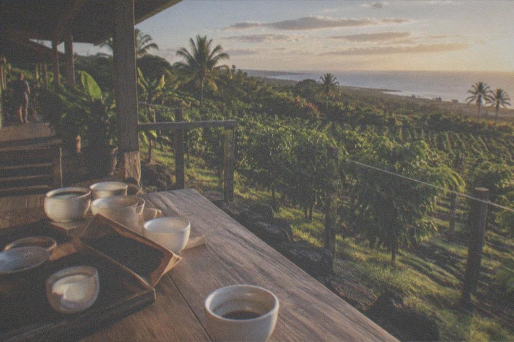
If you are weighing whether any of this is worth the money at all, the is the Kona coffee farm tour worth it piece breaks down what you actually get for the price, and the Kona coffee tasting guide covers the tasting-room side of the belt for visitors who prefer to drink the scenery rather than walk it.
When should you visit the belt?
Come between late August and January to see the belt working: picking, wet milling and sun-drying, with peak activity October through December. November adds the Kona Coffee Cultural Festival, November 6 to 15 in 2026. Outside harvest, roughly February into spring, you get flowering, green berries and pruning instead, plus lighter crowds and easier bookings.
The harvest window is the honest answer for first-time visitors. Watching a picking crew work a slope, then walking into a mill where that same morning's cherry is being pulped, is the difference between a farm tour and a farm walk. The trade-off is crowds: October and November are when everyone else had the same idea, and the small-group tours with caps fill first.
Shoulder months, late August into September, split the difference. Picking has started at lower elevations in South Kona, which run earlier, and the festival has not arrived yet. After the harvest, from roughly February into spring, the trees flower after dry spells, mainly January through April, and the belt turns into a quiet, green orchard with white blossoms. Farmers call the flowering snow, and it is a genuinely beautiful time to walk the rows, even if the mill is quiet.
Whenever you go, book the capped tours ahead and leave the free walk-ups for the day of. Greenwell's free tour needs no reservation, and Mountain Thunder runs free short walk-in tours direct as well, so a flexible day on the belt can always be rescued with a free stop.
Common Questions About the Kona Coffee Belt
What is the Kona coffee belt?
It is the legally defined growing area for Kona coffee: the North and South Kona districts on the western slopes of Hualalai and Mauna Loa, roughly 30 miles long and 2 miles wide, between about 500 and 3,200 feet of elevation. Only coffee grown in those two districts can be labeled 100% Kona.
How wide is the Kona coffee belt?
About 2 miles wide in its core, running roughly 30 miles from north to south. The main growing zone sits between roughly 700 and 2,000 feet of elevation, which is why the farms cluster along the Mamalahoa Highway rather than spreading to the coast.
Why does Kona coffee only grow on the west side of the island?
The western Kona slopes get sunny mornings, near-daily afternoon cloud cover, roughly 60-plus inches of rain a year and fast-draining volcanic soil, at elevations warm enough for coffee but cool enough to slow ripening. The island's east side is too wet, and the coast is too hot and dry.
How long does it take to drive the Kona coffee belt?
The belt is a single morning's drive. Kailua-Kona to Holualoa is about 8 minutes, to Honalo about 14 minutes, and to Captain Cook 23 to 26 minutes. Farm to farm along the highway you are usually 5 to 15 minutes apart.
Which farms on the belt can you tour?
Bookable tours cover Mountain Thunder at Kaloko, Heavenly Hawaiian at Holualoa, Hala Tree and Kona Earth at Captain Cook, and a helicopter landing at Kona Joe. Greenwell Farms at Kealakekua runs a free guided tour daily, direct with the farm, every 30 minutes from 8:30am to 2:00pm, no reservation needed.
When is the best time to visit the Kona coffee belt?
October through December for peak harvest activity, or late August into September for lighter crowds with picking underway. The Kona Coffee Cultural Festival runs November 6 to 15 in 2026. Outside harvest, roughly February into spring, the trees flower and the belt is quiet and green.